
Jessica Webb
editor@thesmokymountaintimes.com
Bryson City Water Supply Dam on Lands Creek is a quiet place these days, where little happens, unless you’re a rattlesnake. The dam plan was among recent Bryson City Town Board of Aldermen discussions, as the town is coming up on its renewal of a required Emergency Action Plan. This year, the plan includes new state guideline requirements that will require geo-modeling and deliverables. The survey work and modeling is estimated to cost $30,000-$40,000 (with subsequent updates to the plan in the future that will be less).
Since it has long been out of use, Town Manager Sam Pattillo wondered if they could abandon the dam, but that option proves impractical and far too expensive at an estimated $500,000, which would require them to physically dismantle the dam and make it more of a natural restoration of the flow path-according to Town Engineer Nate Bowe.
Instead, Manager Pattillo recommended going with the survey plan due to the cost of breachment.
The earth dam structure is 75 feet tall with a surface area of 3.5 acres for the reservoir.
It’s time for the town to renew its Emergency Action Plan that gets submitted to the North Carolina Department of Environmental Quality containing details about the reservoir and dam, and outlines for three emergency scenarios if the dam were compromised, breached or failing.
The plan includes mapping for downstream inundation and hazards, and flow charts for each scenario. Any imminent failure of the dam would lead to immediate evacuation of the Lands Creek community, making use of the county’s CodeRed system to warn residents of any dangers.
If an immediate emergency happened, they would also utilize phone calls and on-the-ground notification.
Travis McCall with the town was always told the water line was laid with horse and drag pan, sometime in the early 20th century. When Lands Creek was first established as a water source, it was at the top of the property, at the “little dam.” The lower, larger one, which is what the plans are for now, was built about 1975.
The dam itself isn’t what most would picture when they think of a dam. Although it’s 75 feet tall, it’s an earthen dam—and is hardly distinguishable from the surrounding landscape.
This was the town’s main water supply until 1994 when the Deep Creek Water Plan came online, according to town staff. Another early water source was on Jenkins Branch.
McCall also said a landslide effected the area of the dam and its systems shortly thereafter. Town crews had to go in and disconnect it from the chlorine house and direct it back to the stream. There’s also a large above-ground tank on the property that supplies water the community (connected to town water).
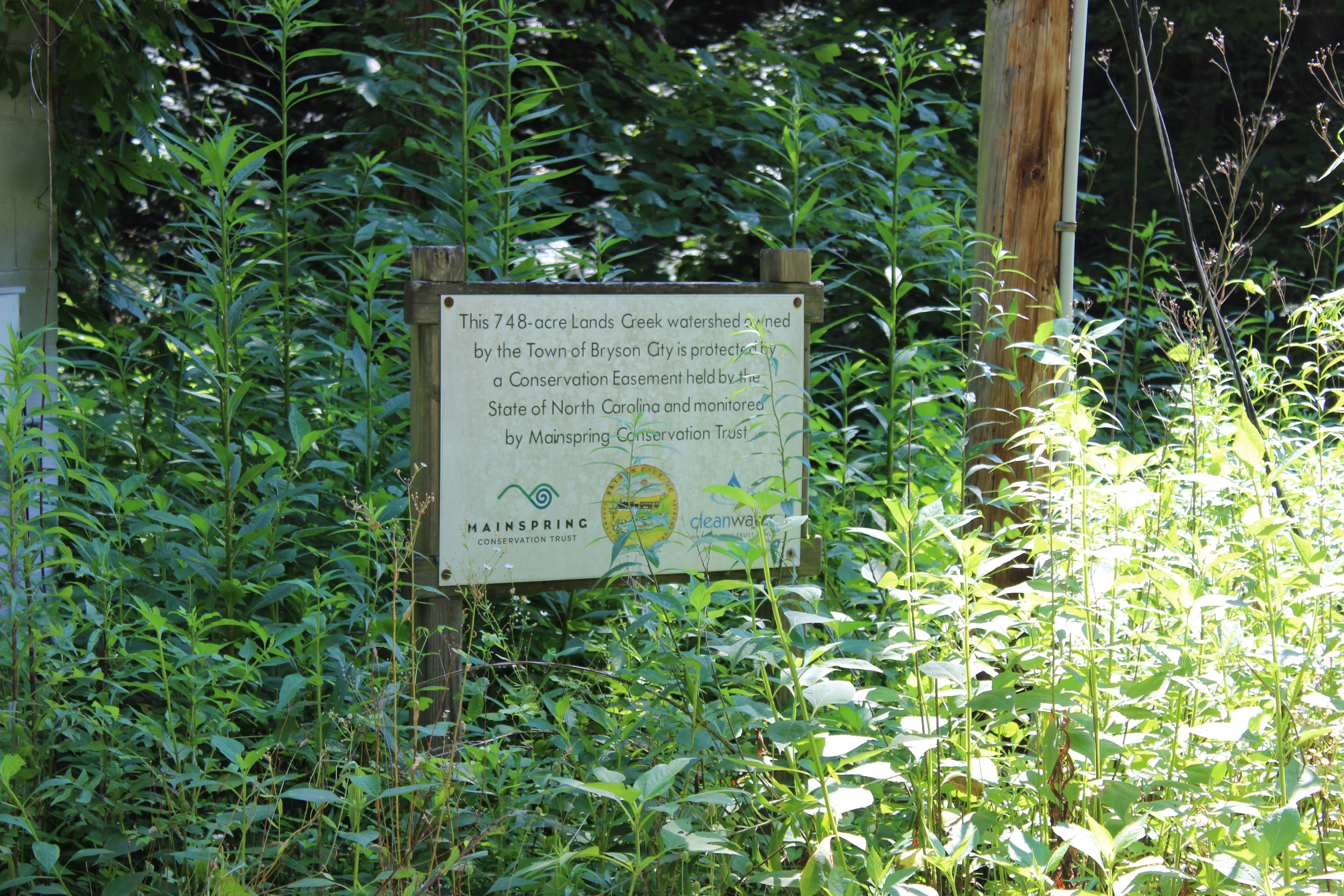
In 2006, the property was put into a conservation easement by North Carolina Land and Water Fund through Mainspring (then Little Tennessee Land Trust), who helps monitor it on an annual basis. It is closed off to the public. The town also conducts general property maintenance, such as trimming trees.